
The Velo 2: a well-rounded option for cycling tours
Exploring a new city, route or area by bike is fun. Getting lost is less so. This is where the small, round Beeline Velo 2 navigation device comes into play. It helps you stay on the right path.
My sense of direction isn’t the best. I also don’t like mounting my phone on my handlebars. The combination is a recipe for getting lost. That’s why I was happy to get the chance to try out the Beeline Velo 2 navigation system for my bike.
After all, not all map apps are suitable for bike navigation, as Martin Jungfer recently explained in an article about Apple’s map app. One more reason to take a closer look at the sat nav for bikes.
Although strictly speaking it’s not a standalone navigation system; it only works with your phone and the Beeline app. So, you still have to have your smartphone with you when you cycle, just not on the handlebars.
First impressions: small, light, bright and clear
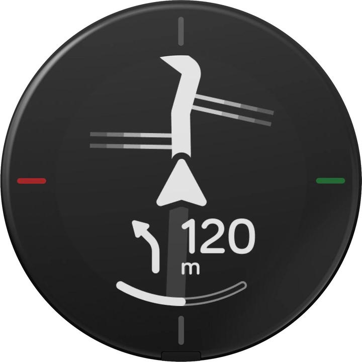
The first impression is pleasing: the device is small with a bright, simple screen. I can read the relevant information at a glance. Even in sunshine.
The round shape appeals to me. It suits the bike. The device is also light. It weighs around 25 grammes and has a diameter of 4.6 centimetres. Handy enough to take with you on a city tour or on holiday if you rent a bike locally.
The Velo 2 can be attached either with the universal mount with two elastic bands or with the stem mount, which has to be purchased separately. Thanks to the twist-lock mechanism, you can attach it to both mounts with a small twist and remove it again after your ride.
I attached the stem mount on my bike at home. I took the universal mount with me on a trip to kit out my rental bike.
Planning routes with the Velo 2
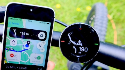
The device is connected via Bluetooth to the Beeline app, which is available for iOS and Android. You can use the app to plan routes in several ways.
Source: Siri Schubert
If you want to keep it simple, enter your destination and choose whether you want the fastest route, which can also be via busy roads, a quiet route or a combination of both. The app will then calculate a suitable route for you.
If you know the route or want to pass through certain places, you can set corresponding waypoints in the app and then save your routes.
Alternatively, you can import GPX routes from Strava. If you have a specific destination in mind but want to find your own way, you can also navigate using a compass. This way you know whether you’re heading in the right direction.
Will it get me to my destination?
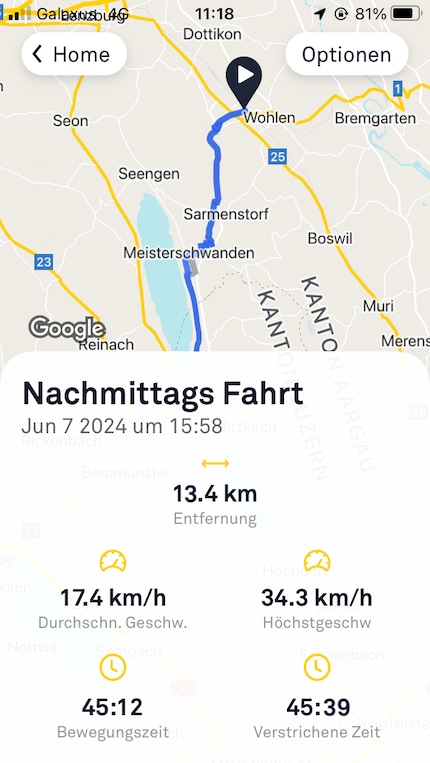
My first test is in familiar surroundings – a trip to the Digitec shop in Wohlen to be precise. I know the most direct route well. It goes along the main road for a while. Now I’m curious to see what alternatives the app suggests. So, I enter the shop’s address, select «quiet route» and head off.
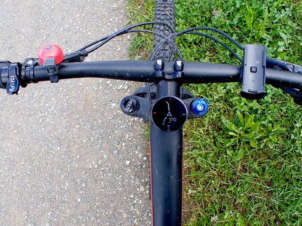
A clear plus point is the screen – the brightness is automatically adjusted using a light sensor. The display shows the routes I should take, a direction arrow and the distance to the next junction. 90 metres before turning, the device beeps once, and 10 metres before the junction, it beeps twice. This allows me to pay attention to the path, traffic and other conditions and still stay on course.
Source: Siri Schubert
The sat nav takes me along easy-to-ride cycle paths, dirt tracks that aren’t officially part of the Swiss cycle routes, and quiet side streets. I even discover beautiful side roads I haven’t ridden on before.
The automatic rerouting is particularly useful. If a road is closed or I want to take a different route, the app automatically recalculates the route and shows it to me on the device. And it’s quick: shortly after driving past the initial junction, I see the new route on the display.
Source: Siri Schubert
The first test was a success – I reached my destination quickly and discovered new routes along the way. On my next trip, I use the device to record and save the route. This also goes smoothly.
Finding my way in new surroundings
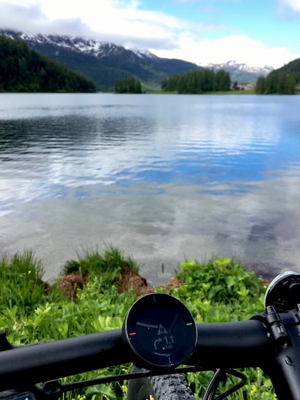
As I want to ride in the Engadine valley for a few days, I’m obviously taking the mini satnav with me. And it serves me well on the first day. As the local bike rental stations are still closed because we’re in pre-season, I take the bus to the next larger town. I use the Velo 2 to get back to the campsite and avoid the main roads.
The tranquil route displayed leads along the lake and through the forest for a while. The device shows me every turn-off precisely. I also plan my next rides in the app.
Source: Siri Schubert
I can also confirm that the device is waterproof. I was caught in a downpour more than once while cycling. The Velo 2 worked well even when wet and my phone was safely stowed in my waterproof backpack.
In a nutshell
A good bike sat nav for commuters and easy rides
The Beeline Velo 2 is a device with an app that’s been specially designed for the needs of bicycle and motorcycle riders, and impresses with its minimalism, clear display and good navigation. It’s well suited for commuters and anyone who likes to explore new routes. As user ratings are taken into account, there’s definitely better information and more reliable route guidance for more popular routes than for trips a long way off the beaten track.
The device is well made and can withstand heavy rain and splashes of mud. However, operating it using the pressure points on the device takes some getting used to. I’ve already failed to turn it off a few times. Instead, it stayed in standby mode, but this had virtually no effect on the battery life – 11 hours according to the manufacturer.
If, like me, you don’t like mounting your phone on your handlebars and are looking for a good way to explore new bike ride or commuting routes, the Beeline Velo 2 might be for you.
Pro
- well-made and weatherproof
- specially tailored to cyclists
- road rating via community feedback
- clear, easy-to-read display with simple instructions
- good, reliable navigation
Contra
- operating the device via pressure points takes some getting used to

Research diver, outdoor guide and SUP instructor – I love being in, on and around water. Lakes, rivers and the ocean are my playgrounds. For a change of perspective, I look at the world from above while trail running or flying drones.
